Cyclone Megan:
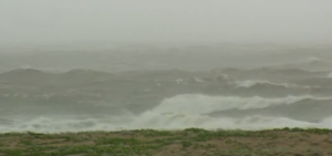
Emergency services are issuing warnings to inland communities across the Northern Territory (NT) as the remnants of Tropical Cyclone Megan, now downgraded to a tropical low, continue to move westward across the territory. After crossing the NT coast as a category three system, the cyclone has weakened but still poses a significant threat of heavy rainfall and potential flooding in its path.

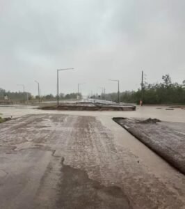
According to forecasts from the Bureau of Meteorology (BOM), communities such as Tennant Creek and Elliot are expected to experience substantial rainfall, with totals ranging from 80 to 200 millimeters over the coming days. Shenagh Gamble, a BOM forecaster, emphasized the possibility of rapid river rises and water over roads due to the intense rainfall, urging residents to stay vigilant and prepared for changing conditions.

NT Chief Minister Eva Lawler highlighted concerns about the potential closure of the Stuart Highway, the main highway in the NT, due to flooding. Additionally, the McArthur River catchment is forecasted to exceed major flood levels, further raising the risk for affected communities.
NT Police Superintendent Sonia Kennon stressed that the threat from ex-Tropical Cyclone Megan is far from over, emphasizing the importance of emergency planning and preparedness. Local authorities are actively engaging with communities, urging them to stock up on essential supplies and prepare for possible evacuation if necessary.

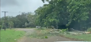
The town of Borroloola faced a particularly tense situation as plans for evacuation were suspended due to deteriorating weather conditions, leaving residents to seek shelter within the community. Initial reports from SecureNT indicate no injuries and minimal damage within Borroloola, primarily consisting of fallen trees.
However, criticisms have arisen regarding the handling of the evacuation plan, with some community members expressing frustration at perceived delays in initiating the evacuation process. Senior Garawa leader Keith Rory pointed out the need for earlier action based on forecasting data, suggesting that the community was left vulnerable by the delayed response.
Meanwhile, the impact of the cyclone extends beyond residential areas, affecting crucial infrastructure and industries in the region. The Groote Eylandt Mining Company (GEMCO), a major manganese mine jointly owned by South32 and Anglo-American, suspended operations after its wharf sustained damage from a Cyprus-registered bulker driven into it during the storm.
While Groote Eylandt itself did not bear the brunt of the cyclone, the island experienced strong winds and heavy rainfall, disrupting mining activities and prompting evacuations. The cyclone’s trajectory indicates a further inland movement, potentially bringing heavy rain and flash flooding to the Carpentaria region.
This event underscores the vulnerability of remote communities and vital industries to extreme weather events in Australia’s northern regions. As the cyclone continues to track inland, authorities and residents alike remain on high alert, emphasizing the importance of preparedness and community resilience in the face of such natural hazards.


